

Park · Vancouver · ⭐ 9.5/10 · 3527 reviews · updated: 2026-08-04 20:18:42
Address: Cypress Bowl Rd, West Vancouver, BC V0N 1G0, Canada
Cypress Provincial Park — the Olympic mountain above West Vancouver
Cypress is not a Vancouver city park and it is important to say so plainly: it is a Class A provincial park in the North Shore mountains above West Vancouver, on the far side of Burrard Inlet, reached only by road up a long series of switchbacks. From downtown Vancouver the drive is usually somewhere between thirty and forty-five minutes — across the bridge to the North Shore, west along the highway, then a climb of roughly fifteen kilometres on a single mountain road that ends in a high bowl at around a thousand metres. What you get for that effort is a genuine mountain: thousand-year-old yellow cedars, subalpine meadows, ridge trails looking straight down Howe Sound, and the slopes that hosted the freestyle skiing and snowboard events of the 2010 Winter Olympic Games.
Highlights
- The 2010 Olympic venue — moguls, aerials, ski cross, halfpipe, snowboard cross and parallel giant slalom were all contested here in February 2010; it was on this hill that Alexandre Bilodeau took the men’s moguls on 14 February, Canada’s first Olympic gold ever won on home soil, and Maëlle Ricker of North Vancouver won women’s snowboard cross two days later.
- Yew Lake Trail — a flat, wide, wheelchair-accessible loop through old-growth forest and meadow that reaches a small subalpine lake within ten to fifteen minutes of the trailhead, with the peaks standing directly in the water.
- Ancient yellow cedar — the tree that gave the park its misleading name (early loggers called yellow cedar “cypress”). Specimens here run past a thousand years; one roadside giant has been dated at over 1,200 years and ranks among the largest yellow cedars in British Columbia.
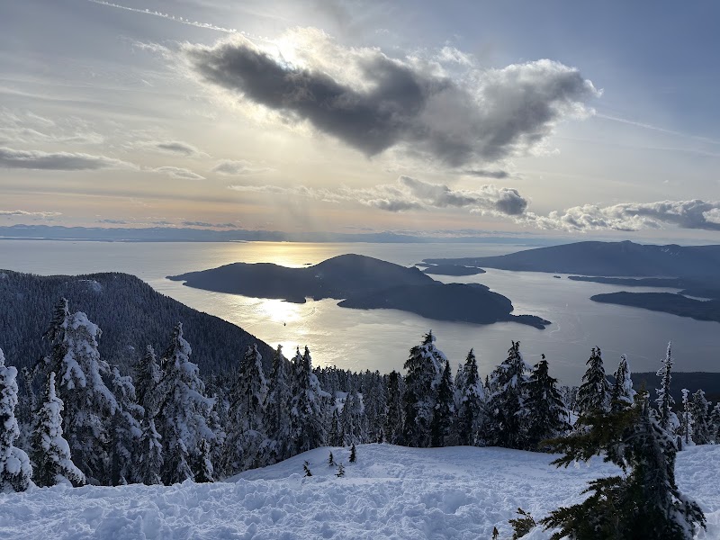
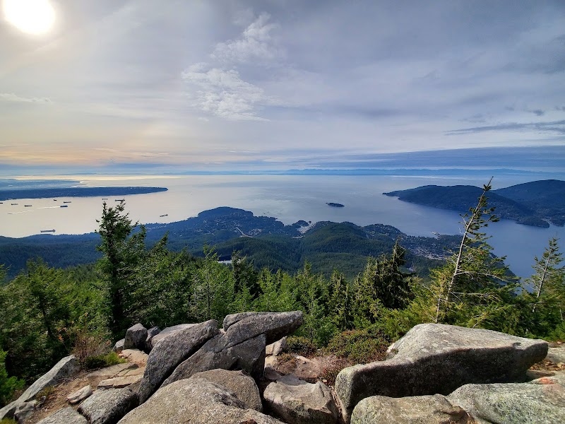
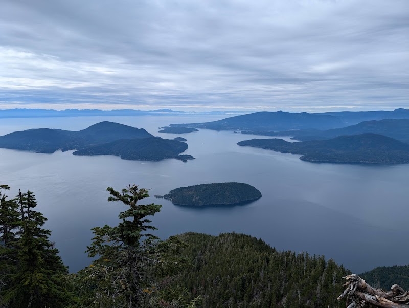
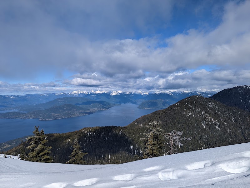
- Howe Sound viewpoints — Bowen Lookout and, higher and rougher, Eagle Bluff and St. Mark’s Summit deliver the classic view down the fjord to Bowen Island and the islands beyond.
- Three summits around one bowl — Black Mountain, Mount Strachan and Hollyburn Mountain enclose Cypress Bowl, and each carries its own trail network and its own character.
- The Nordic side — a separate area on Hollyburn with cross-country tracks, a large network of dedicated snowshoe trails, tobogganing and snowtubing, run apart from the alpine slopes.
What you’ll find
The park covers about thirty square kilometres in two pieces: a southern block wrapped around Cypress Bowl and its three mountains, and a northern block strung along a high ridge running toward Howe Sound. A commercial ski operator holds a park use permit for the lifts, runs and day lodges inside the southern block, so the same square kilometre can hold a chairlift, a groomed race course and a stand of forest that has not burned in fifteen hundred years. Snow lies deep here — three metres and more on the ridges in a normal winter — and everything about the vegetation, from the stunted mountain hemlock to the bog laurel in the meadows, is shaped by that.
- Cypress Bowl: the alpine ski area with six lifts, over fifty runs and the greatest vertical drop of any North Shore ski hill.
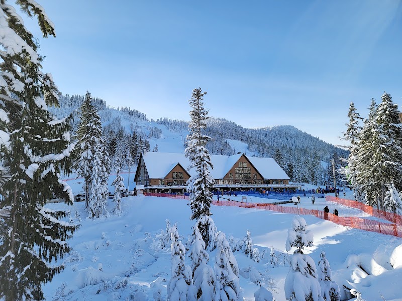
- Hollyburn: the nordic area, with groomed cross-country track, night skiing lanes, snowshoe routes and family snow play.
- Yew Lake and Yew Meadows: the park’s most important natural wetland complex, with boardwalk and interpretive signage.
- Maintained backcountry winter routes to Bowen Lookout, the Black Mountain plateau and Hollyburn Peak.
- The long ridge trail running north past St. Mark’s Summit toward The Lions and Brunswick Mountain, plus a section of the Baden-Powell Trail through the southern block.
- Day lodges, food service, rentals and washrooms at the two base areas; wilderness camping in designated backcountry terrain, with a permanent year-round campfire ban.
Things to do — and who it’s for
- Skiers and snowboarders — a full-scale alpine hill less than an hour from a major city, with terrain from beginner runs to the Olympic slopes, and night skiing under lights over the lights of Vancouver.
- Families with young children — the snow play and tubing area, the gentle nordic trails and the flat Yew Lake loop in summer all work for legs that are not yet mountain legs.
- Day hikers — Bowen Lookout and the Black Mountain loop give a real summit view for a couple of hours’ effort in summer; Hollyburn Peak is a solid half day.
- Serious hikers and ridge walkers — the Howe Sound Crest Trail runs the length of the park’s northern section and is a long, exposed, genuinely demanding route.
- Snowshoers and cross-country skiers — a large dedicated network on the nordic side keeps them entirely clear of downhill traffic.
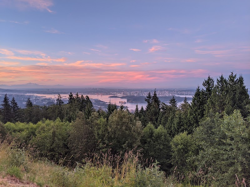
- Naturalists and photographers — old growth, meadow wildflowers, more than a hundred recorded bird species, and a viewpoint over an entire city and a fjord in the same frame.
Getting there & practical
Cypress sits above West Vancouver on the North Shore, not within the City of Vancouver, and there is no way in other than by road. Drivers cross to the North Shore, run west on the highway and turn up the mountain road that climbs to the nordic area first and then continues a couple of kilometres further to the alpine base at the end of the road; allow thirty to forty-five minutes from downtown in good conditions and considerably more on a snowy Saturday morning. There is no regular year-round public transit to the park. In the ski season a private coach service runs up from the SeaBus terminal at Lonsdale Quay — reachable from Waterfront Station — and from pickup points in West Vancouver, the West End, Kitsilano and Richmond; taking the SeaBus and joining the coach at the quay is usually the quickest car-free option. Entering the provincial park costs nothing, but the mountain has two separate money questions: parking is free year-round in the designated lot and on marked shoulders, while other areas may become pay parking through the winter months, and the ski operation sells its own lift tickets, rentals and lessons. Winter tyres are a legal requirement on this mountain road through the cold half of the year, and chains are sometimes called for on top of that. Dogs must be leashed everywhere in the park and are not permitted on the Yew Lake Trail when it is snow-free. Campfires are banned all year. Plan on a half day for a hike and a viewpoint, a full day for skiing, and check the mountain forecast before you leave the coast — it can be raining at sea level and blowing snow at the top.
When to visit
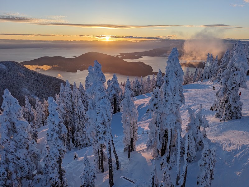
Winter is the main event and the reason most people come. Snow generally arrives on the bowl by late November or December and can hold into April, sometimes later on the shaded north aspects; the alpine and nordic areas both run through this window, night skiing included, and a clear evening puts the whole lit city underneath you while you ride. Spring is a slush-and-sunshine season, excellent for late skiing and for the first walkable stretches of the lower trails, but the upper routes stay under deep, unstable snow far longer than newcomers expect and hazards such as tree wells and creek holes persist. Summer is the hiking season: Yew Lake and the meadows come into flower from July, the ridge trails clear by mid-summer, and the long northern route becomes feasible. Autumn is the quiet reward — blueberry and huckleberry colour in the subalpine, clean air, empty trails and the sharpest Howe Sound views of the year, though weather turns fast and the first snow can fall on the ridges while the city is still in shirtsleeves.
Good to know
The name is a botanical accident. The tree that dominates the higher slopes is yellow cedar, also called yellow cypress, abundant above roughly eight hundred metres, and the loggers who worked these slopes called it cypress; the bowl and then the park inherited the word. Logging shaped the mountain for decades before recreation did, and the road that now carries skiers up was completed in 1973 to serve the cut. The park was granted Class A provincial status in 1975 and enlarged in 1982 when the northern ridge and its long crest trail were added, bringing the total to just over thirty square kilometres. The human history runs far deeper: these are the territories of the Squamish and Tsleil-Waututh peoples, and above Yew Lake researchers have documented bark-stripping scars on living old-growth yellow cedars that are three hundred and fifty to four hundred years old — physical evidence of use of this forest centuries before any road existed. The geology is older again: the mountains are middle Jurassic sedimentary and volcanic rock later intruded by granite, and about sixteen thousand years ago ice more than a kilometre thick covered all three summits, retreating around fourteen thousand years ago and leaving the striations and erratic boulders you can still pick out beside the trails. Studies of these snow forests suggest they have gone fifteen hundred to two thousand years without major fire, which is why so many trees here are measured in centuries. And then there is 2010. Cypress was chosen as the freestyle skiing and snowboard venue for the Vancouver Winter Olympic Games, and it very nearly did not work: the winter was among the warmest on record, and organisers pushed, trucked and helicoptered snow onto the courses from higher ground and eventually from Manning Park more than two hundred kilometres inland. The competitions went ahead on that imported snow, and the two golds won here — Bilodeau’s and Ricker’s — remain the ones Canadians remember first from those Games.
Visitor tips
- Check the road and the mountain weather before you set out, and fit proper winter tyres: this road is legally a winter tyre route and is regularly closed or restricted in heavy snow.
- Dress for a summit, not for the city. The bowl sits about a thousand metres above sea level and routinely runs many degrees colder and far windier than the waterfront you left.
- If you are heading beyond the maintained trails in winter, treat it as backcountry: use the marked access corridor, carry avalanche gear and know how to use it, and turn around early — travel past the standard lookouts is strongly discouraged in snow.
Questions & answers
Is Cypress Provincial Park in Vancouver? No. It is a British Columbia provincial park in the mountains above West Vancouver, on the North Shore across Burrard Inlet from the city. It is normally a thirty to forty-five minute drive from downtown Vancouver and it is not walkable or reachable on regular city transit.
Do I have to pay to enter the park? Entry to the provincial park itself is free. Parking is free year-round in the designated lot and on marked shoulders, but other areas may be charged parking through the winter, and the ski area operator sells lift tickets, rentals and lessons separately.
Can I get there without a car? In the ski season, yes: a private coach service runs to the mountain from the SeaBus terminal at Lonsdale Quay and from pickup points around Metro Vancouver. Outside the snow season there is no scheduled service, so summer hikers generally drive or arrange a lift.
What was held here at the 2010 Olympics? All the freestyle skiing events — moguls, aerials and ski cross — and all the snowboard events — halfpipe, snowboard cross and parallel giant slalom. Alexandre Bilodeau’s moguls gold on 14 February 2010 was Canada’s first Olympic gold won on home soil.
Is Yew Lake Trail suitable for a stroller or a wheelchair? Yes, in the snow-free months. It is a wide, flat, surfaced loop, and the lake is reached within about ten to fifteen minutes of walking. Note that dogs are not allowed on this trail when it is snow-free.
Are dogs allowed in the park? Yes, on a leash throughout, and not inside park buildings. The Yew Lake Trail is the exception where dogs are excluded during the snow-free season.
Can I camp or light a fire? Wilderness camping is permitted in designated backcountry terrain, but there is a permanent campfire ban in force year-round across the park, in every season and in all weather.
How hard are the hikes? They range widely. Yew Lake is flat and easy; Bowen Lookout and the Black Mountain loop are a couple of hours of moderate climbing; Hollyburn Peak and Eagle Bluff are half-day efforts on rougher ground; and the long ridge route north is a serious, exposed, all-day undertaking for experienced hikers only.
What wildlife might I see? Black bears, black-tailed deer, coyotes, squirrels, hares and weasels are all present, cougars occasionally, and more than a hundred bird species have been recorded. Carry food securely, keep dogs leashed and give bears a wide berth.
Photos
Show 1 more photos
Visitor reviews
Reviews last updated: 2026-08-04 20:18:42
Data is refreshed monthly. Sources: vancouver-name.com and editorial picks based on reviews.
A very nice snowshoe walk. The trails were very well marked. The lanterns along the snowshoe route were lovely, and the Baileys hot chocolate really hit the spot.
Had a great time tubing at Cypress Provincial Park! The $29 advance booking was worth it, because it was a fun and thrilling adventure. The tubing lanes were well maintained, and the staff kept everything running smoothl…
The sunset in summer is a breathtaking sight, especially if you can make it to the top. We only got as far as the road, from where you can see downtown and all of Vancouver. It's a quiet and peaceful place worth being at…
An incredible experience out in nature. There's a playground available for short-distance play, and picnic spots. The atmosphere and the freshness of the air here are majestic and magical. The clouds were right overhe…
Nice mountain hikes with scenic lookouts. Unfortunately, we went when there was a bit of wildfire smoke, so visibility was poor. But I'll definitely come back after a while, once the smoke clears, for the next hike. Be s…